UN
210 Dunsbury Way
£ 37,000
Description
We don't have a Description for this property.
- Bedrooms
- 3
- Bathrooms
- 0
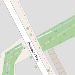

Leaflet © OpenStreetMap contributors
The heatmap indicates the level of crime in the area. The color of the heatmap indicates the crime severity and recency.
Metrics Year-on-Year
- Average area value
- 436,333.00 £Decreased by 35.99 %
- Average area rental value
- 1,469.00 £/moIncreased by 1.10 %
- Est rental Yield
- 4.04 %Increased by 57.81 %
- Crime Rate
- 6.00 %Unchanged by 0.00 %
from 681,667.00 £
from 1,453.00 £/mo
from 2.56 %
from 6.00 %
Nearby Schools
| Name | Type | Ofsted | Distance |
|---|---|---|---|
| Riders Junior School | Community School | Requires improvement | 0.48 KM |
| Riders Infant School | Community School | Requires improvement | 0.48 KM |
| Trosnant Infant School | Community School | Good | 0.94 KM |
| Trosnant Junior School | Community School | Good | 0.94 KM |
| Trospacc Children'S Centre | Children's Centre | 0.94 KM |
Images
Nearby Streets
| Name | Average Price | Average Sqft | Distance |
|---|---|---|---|
| Cotswold Close | £ 335,000 | 0 | 0.00 KM |
| Eastover Court | £ 0 | 0 | 0.00 KM |
| New Road Roundabout | £ 330,000 | 0 | 0.00 KM |
| Conford Court | £ 240,000 | 0 | 0.00 KM |
| Amport Court | £ 260,000 | 0 | 0.00 KM |
Nearby Transport
| Name | NLC | TLC | Distance |
|---|---|---|---|
| Havant | 5532 | HAV | 1.75 KM |
| Bedhampton | 5538 | BDH | 1.88 KM |
| Warblington | 5264 | WBL | 2.86 KM |
| Rowlands Castle | 5658 | RLN | 4.24 KM |
| Emsworth | 5257 | EMS | 5.79 KM |
Nearby Listings
| Address | Price | Type | Score | Distance |
|---|---|---|---|---|
| Little Hackets, Leigh Park | £ 270,000 | BUY | 7 / 10 | 0.14 KM |
| Little Hackets, Havant | £ 185,000 | BUY | 5 / 10 | 0.18 KM |
| Little Hackets, Havant, Hampshire | £ 255,000 | BUY | 7 / 10 | 0.18 KM |
| Little Hackets, Havant | £ 155,000 | BUY | 5 / 10 | 0.20 KM |
| Little Hackets, Havant, Hampshire, PO9 | £ 150,000 | BUY | 6 / 10 | 0.22 KM |
Nearby Properties
| Address | Price | Distance |
|---|---|---|
| 210 Dunsbury Way | £ 37,000 | 0.00 KM |
| 218 Dunsbury Way | £ 230,000 | 0.04 KM |
| 175 High Lawn Way | £ 64,000 | 0.17 KM |
| 28 High Lawn Way | £ 220,000 | 0.17 KM |
| 21 High Lawn Way | £ 230,000 | 0.17 KM |